Urban training should represent the city as a connected, three-dimensional environment. Streets lead into buildings. Buildings contain rooms, corridors, stairways, and restricted spaces. Below them may be parking structures, utility passages, transit systems, or purpose-built tunnels. When these layers are trained separately, teams miss the transitions that make urban environments difficult to understand and manage.
Urban terrain extends above and below the street
A city is rarely a flat collection of roads and buildings. Its usable spaces continue vertically through upper floors, rooftops, basements, transport infrastructure, service corridors, and underground networks. These layers affect visibility, communication, orientation, movement, and the information available to decision-makers.
The U.S. Army has been examining this connection directly. A June 2026 Center for Army Lessons Learned paper, Hamas Tactics in Gaza: Lessons for the Urban Defense of Taiwan, discusses high-rise buildings and underground infrastructure as parts of the same urban operating environment. It also describes the use of satellites, unmanned aircraft systems, and other reconnaissance capabilities to build a clearer picture of complex terrain.
The paper is an analytical publication, not Army doctrine. Its relevance for training planners lies in the way it frames the problem: surface and subterranean spaces are connected, and both must be understood within a wider urban system.
Earlier Army analysis makes the same physical point. An Army University Press article on dense urban environments states that urban terrain often includes a subterranean level. A 2024 paper on large-scale combat operations and the subterranean dilemma, published by the U.S. Army Nuclear and Countering Weapons of Mass Destruction Agency, identifies underground parking garages, transportation corridors, sewage systems, and high-rise buildings among the features that add vertical complexity to urban operations.
For training infrastructure, the conclusion is practical: a tunnel is one layer of an urban environment, not an isolated setting.
Download Integrated Urban Training Settings Planner (PDF)
A practical worksheet for connecting streets, buildings, CQB spaces, and subterranean environments for integrated tactical training: Urban Training layer Map, Environment Inventory, Connection-point checklist – Download PDF
The transition between spaces is part of the training problem
A team may understand a street layout, perform well inside a familiar building, and remain comfortable in a tunnel when each setting is used independently. A connected environment presents a different problem. Information gathered in one area may become incomplete after moving indoors or underground. Sightlines change. Space narrows. Lighting and acoustics change. Radio performance may change. Navigation becomes harder when familiar external references disappear.
These transitions are where an integrated training environment adds value. The route can move through several forms of terrain without treating each one as a separate exercise:
| Urban layer | Training infrastructure | Environmental problem represented |
|---|---|---|
| Open urban area | Streets, walls, vehicles, and exterior obstacles | Long and short sightlines, multiple approaches, exterior orientation |
| Building edge | Doors, windows, alleys, and access points | Change from open space to restricted entry |
| Interior | Rooms, corridors, furniture, and internal partitions | Limited visibility, layout interpretation, team coordination |
| Restricted space | Narrow lanes, low-clearance areas, and confined passages | Reduced mobility, equipment constraints, tighter spacing |
| Subterranean layer | Modular tunnel sections and junctions | Limited light, fewer reference points, constrained communication |
| Cross-layer observation | Small unmanned aircraft systems, cameras, and sensors | Building a common picture across separated spaces |
An effective facility represents the relationships that matter at a practical scale. A street should lead somewhere. An entrance should change the conditions. A building should connect logically to restricted or underground space. Instructors can then evaluate whether personnel maintain orientation, communication, and shared understanding as the environment changes.
Integrated training depends on functional connections
Placing a shoot house beside a tunnel does not automatically create an integrated urban environment. The connection must support the learning objective.
Training planners should consider five infrastructure questions:
1. Can the route cross several urban layers?
The layout should allow a scenario to begin in an exterior area, continue through a structure, and reach a confined or subterranean section where appropriate. The sequence can also be reversed. The relevant feature is continuity between spaces.
2. Can instructors change the connection points?
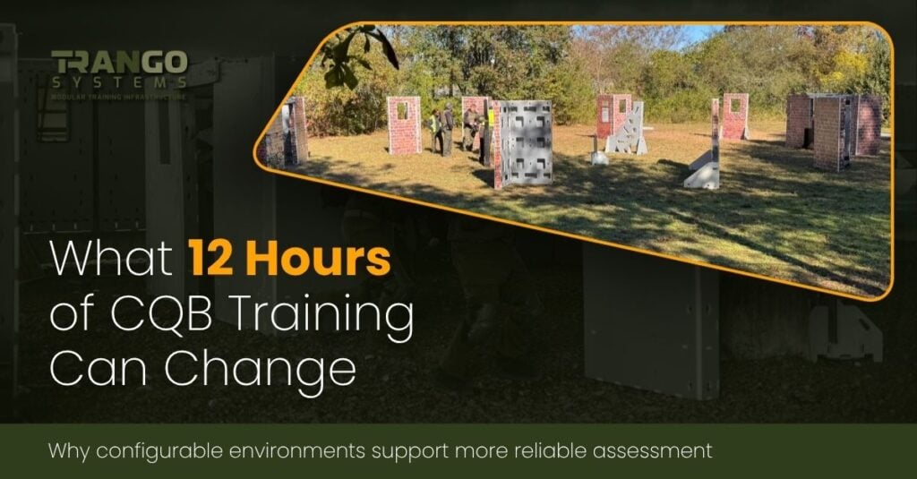
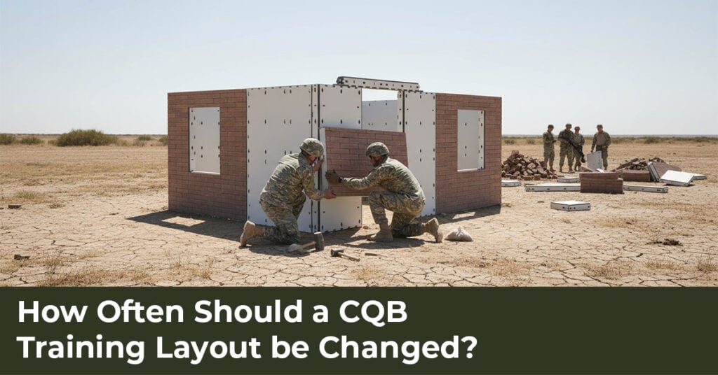
If the same doorway always leads to the same corridor and tunnel entrance, repetition can become layout memorization. Reconfigurable walls, entries, junctions, and passages let instructors retain the training objective while changing the physical problem.
This principle also applies within individual CQB environments. The article How Often Should a CQB Training Layout Be Changed? explains why layout changes should follow the training phase rather than an arbitrary schedule.
3. Does the environment support observation and review?
Complex layouts are harder to supervise. Instructors need suitable observation points, cameras, or other review methods that match the facility and exercise design. This is important when participants move between areas with different visibility and access conditions.
4. Can unmanned systems operate across the same environment?
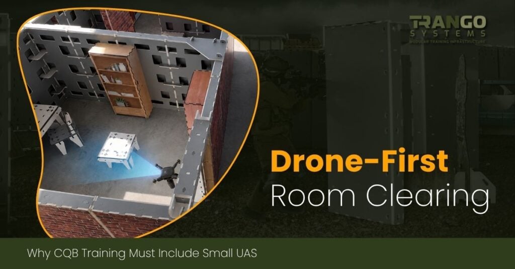
The June 2026 Army paper includes unmanned aircraft systems in its discussion of urban reconnaissance and recommends robotics and drones as part of subterranean preparation. Training infrastructure should therefore allow operators to test what a platform can see, where control or video links become unreliable, and how information is transferred to personnel in other parts of the environment.
For a focused discussion of this requirement, see Drone Operations Training in Realistic Tactical Environments.
5. Can the environment grow with the training program?
An integrated urban facility does not need to be acquired as one large, fixed build. A program may begin with a modular shoot house or CQB training tracks, then add a street environment and subterranean infrastructure as requirements develop. Compatibility between components matters because expansion should create connected scenarios rather than separate islands of equipment.
Reconfiguration supports progression without making training predictable
Integrated training should still follow a deliberate progression. Personnel first need to understand each environment and its constraints. Later exercises can combine layers and introduce more transitions. The infrastructure should let instructors increase complexity without changing the core assessment standard.
For example, the standard may focus on maintaining orientation, communication, identification, and coordination across a route. The physical layout can change while those evaluation points remain consistent. This gives instructors a repeatable assessment without turning the facility into a memorized course.
Modularity is especially useful here. Walls, rooms, streets, and tunnel junctions can be reorganized to create new connections. The same components can support a focused session in one layer or a longer exercise spanning several layers. Training value comes from purposeful configuration, not from complexity for its own sake.
How Trango Systems connects the urban training layers
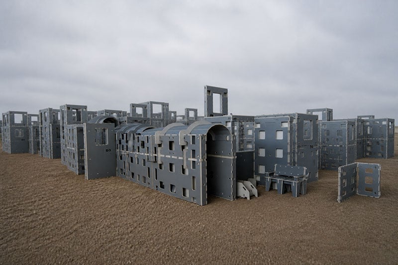
Trango Systems uses compatible modular components across shoot houses, CQB lanes, street environments, and tunnel systems. Tunnel sections can connect with wall-based systems, allowing a training area to represent movement from exterior urban space into buildings, restricted areas, and subterranean passages. Layouts can be reconfigured as objectives change, while furniture, vehicles, targets, and other scene elements add relevant context. The result is a scalable infrastructure system for training across connected urban layers rather than treating each environment as a separate category.
Plan the city as a connected training environment
Urban training does not stop at the building entrance or at ground level. Current Army analysis treats streets, structures, underground infrastructure, reconnaissance, and unmanned systems as parts of one complex terrain problem. Training facilities should reflect that relationship at an appropriate scale.
The planning question is therefore broader than whether a program has a shoot house or a tunnel. The better question is whether its infrastructure allows people, information, and unmanned systems to move through connected urban layers under changing conditions.
To discuss a modular configuration that connects street, CQB, building, and tunnel environments, contact Trango Systems.
Frequently Asked Questions
-
Why should tunnel training be connected to urban training?
Urban underground spaces often connect directly to buildings, streets, parking areas, transport routes, and service infrastructure. Connecting them in training allows instructors to represent the transition between surface and subterranean conditions.
-
What does a three-dimensional urban training environment include?
It may include streets, building exteriors, rooms, corridors, stairs, restricted passages, basements, tunnels, and observation or unmanned-system capabilities. The exact combination should follow the training objective.
-
Why is reconfiguration important in an integrated facility?
Reconfiguration allows instructors to change routes, access points, rooms, and junctions while retaining consistent evaluation criteria. This reduces dependence on a memorized layout and supports progressive training.
-
Can drones be included in urban and subterranean training?
Yes, when the platform and facility are approved for the intended use. Connected layouts can help operators assess navigation, observation, communications, and information-sharing across exterior, interior, and underground spaces.